All about Peter I |
All about Peter I |
Human history:
Discovered by the Russian explorer, Thaddeus Bellingshausen, on Jan. 21, 1821 and named for Peter the Great. At the time of its initial discovery it was the first land to be found south of the Antarctic circle. There were no landings on the island until 2 Feb 1929, when Ola Olstad, in the second "Norvegia" expedition, claimed it for Norway. Prior to the Antarctic Treaty, the Norwegians maintained automated weather stations there. In Feb 1948, H. Holgersen visited the island, from whose observations much of our early knowledge of the island's avifauna comes.
Location and main features:
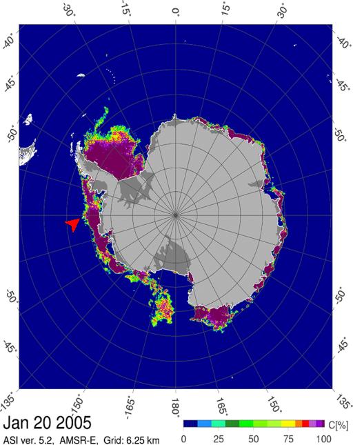
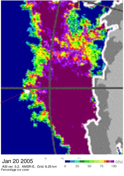
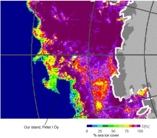
This is the only oceanic island in the extreme South Pacific zone of the Southern Ocean. It lies west of the Antarctic Peninsula and south of the Antarctic Circle, at 68° 50'S,90° 35'W in the Bellinghausen Sea. Peter I Island is surrounded by dense pack ice almost year-round; the pack ice often extends 25 miles or more on every side. The nearest land, in West Antarctica, is 450 km away.
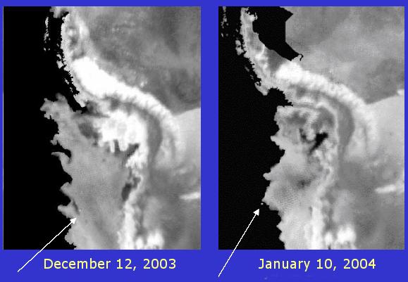
If you're wondering why we don't go in July, here's what the ice looks like then:
Landform, climate and habitat:
Almost 95% glaciated, ice fields extend to the sea at most points around the island, although there are three small, exposed rocky beaches where it is possible to make landings. However, the only way onto the glacier is with a helicopter. The climate is harsh with strong winds, freezing temperatures and snow; in consequence the vegetation consists almost exclusively of mosses and lichens that have adapted to the extreme climatic conditions.
Except in late summer, the island is surrounded by dense pack ice year-round. Peter I is 18 km long and 8 km wide, covers 156 km˛ and rises to 1755m at Lars Christensen peak, which is an extinct volcano with an ice-filled crater 100m wide. Some of the island's rocks date from 13 million years ago and Peter I marks the highest point of a single huge, but extinct volcano. Two ice-free, flat-topped columnar rocks, the Tvistein Pillars, lie just east of the steepest coast of the
island. A high central piedmont plateau dominates the west, while gradual shelves of glacial ice characterize much of the north and south coasts.
Birds:
There are a few data available for this rarely visited island: a tiny population of Adelie Penguin has been noted on several occasions (20 pairs in 1948 and 50 pairs in 1990), while Chinstrap Penguin has also been reported breeding (four pairs in 1948, but none found in 1990). South Polar Skua also nests, as well as large numbers of cliff-breeding Southern Fulmars. Possible nesters are snow Petrel and
Wilson's Storm-petrel. There are several records of Arctic Tern from the Bellinghausen Sea during the southern summer.
Marine mammals:
Large numbers of seals are found both on land and in the surrounding waters, particularly the Crabeater and Leopard Seals. In 1999, a two-year-old Southern Elephant Seal, which had been tagged on Macquarie Isl. was discovered on a tiny beach on the island.
Main conservation issues:
No threats to the island's fauna and flora are known.
Other comments:
Several tourist ships have brought visitors since 1980 but there have been no regular landings. According to Graham Collier in his book "Antarctic Odyssey", his landing there in 1998 was only the ninth known landing. He commented in his book " I think to myself that if there really is a God, He long ago abandoned this place, leaving it subject to the darkest, most violent forces of nature. If time is measured, it is in millennia, distance in light years."
The above information was collected from several sources:
"The complete Guide to Antarctic Wildlife", Hadoram Shirihai & Brett Jarrett, 2002, page 475, from the website www.tea.rice.edu/reynolds/3.24.2000.html and "Antarctic Odyssey" by Graham Collier & Patricia Graham Collier, 1999.
